Learn More
-
United States -
United Kingdom -
India -
France -
Deutschland -
Italia -
日本 -
대한민국 -
中国 -
台灣
-
Ansys si impegna a fare in modo che gli studenti di oggi abbiano successo, fornendogli il software gratuito di simulazione ingegneristica.
-
Ansys si impegna a fare in modo che gli studenti di oggi abbiano successo, fornendogli il software gratuito di simulazione ingegneristica.
-
Ansys si impegna a fare in modo che gli studenti di oggi abbiano successo, fornendogli il software gratuito di simulazione ingegneristica.
-
Contattaci -
Opportunità di lavoro -
Studenti e Accademici -
Per Stati Uniti e Canada
+1 844.462.6797
Project Loch Ness
Synthetic Complex Radar Data Set for AI/ML Training and Validation
Get Training and Validation Data Set for AI/ML
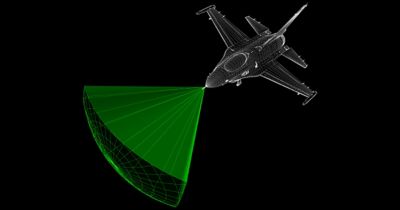
Introducing a comprehensive training and validation data set (data lake) for a specific ground-based AI/ML target detection scenario.
Get complimentary data for the development of new AI/ML algorithms.
Note: To register and download the data, you will be redirected to AGI.com and will need to create an AGI web account (if you do not already have one). Any questions or need help creating an AGI.com account, please contact support@agi.com.
View the complete Project LOCH NESS YouTube Channel for latest and most up-to-date information!
Learn More
Enhancing AI Training with Synthetic SAR Data
Satellite imagery offers large-scale, consistent, and frequent observations of the Earth’s surface. Invaluable for decision-making in government and commercial applications, organizations are challenged with analyzing exponentially increasing amounts of data with a limited number of experts.
AI offers a solution to handle this large volume of data. The AI algorithms require training data to identify desired objects in complex SAR (Synthetic Aperture Radar) scenes, but relying on existing satellite data as the primary source of training data is problematic. Real data may contain collection system artifacts that may pollute or bias the training data. Ansys RF Channel Modeler will generate synthetic SAR data that helps train and validate these new AI algorithms. Ansys offers a complimentary data set of a specific ground-based object detection scenario to explore how well-structured synthetic data can be used. It will enable organizations to demonstrate the effectiveness of their AI/ML detection algorithms.
